The rapid development of El Niño in 2026 is expected to significantly alter weather patterns across the globe. Meteorologists have noted that this year’s phenomenon is intensifying faster and stronger than initially projected, with signs pointing toward a potential Super El Niño by the latter half of the year.
A powerful oceanic Kelvin wave has surged through the Pacific, effectively ending the multi-year La Niña influence that had dominated prior seasons. This shift brings a cascade of changes, as the ENSO (El Niño-Southern Oscillation) cycle plays a crucial role in determining global climate conditions.
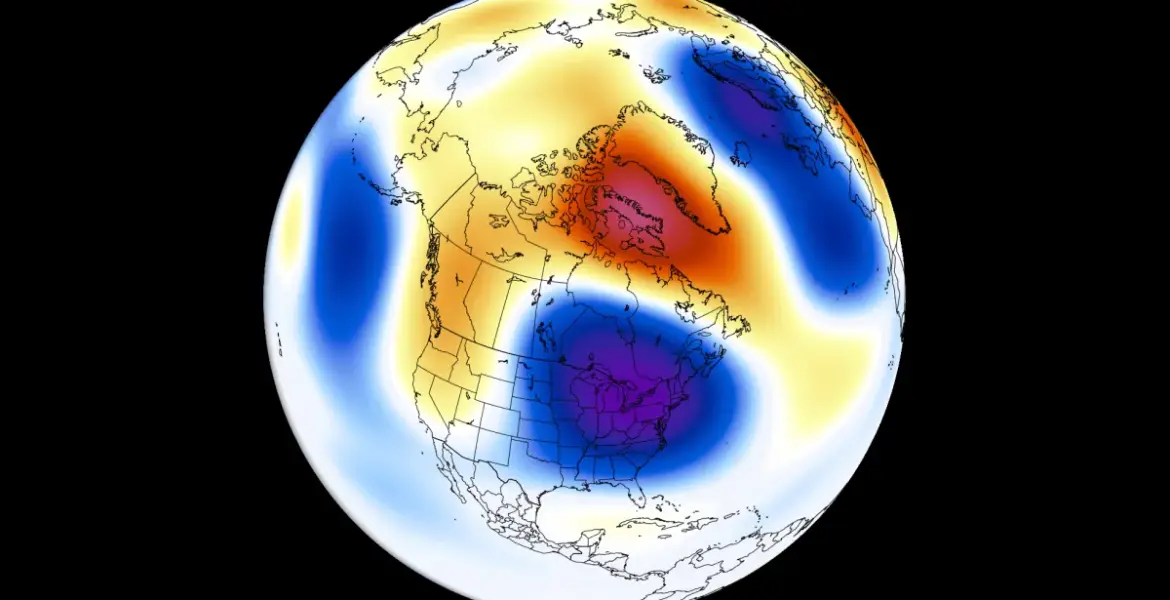
Key impacts anticipated:
- A low-pressure area is forecast over eastern Canada and the northeastern United States during Summer 2026.
- Above-normal temperatures are expected across the northwestern United States and western Canada.
- Increased rainfall is likely over the western, central, and northeastern United States, along with parts of the Midwest and southeastern Canada.
- Conversely, less precipitation is forecast for the far southern United States and across southern and central Canada.
Recent models from ECMWF and UKMO show a much stronger El Niño signature in summer pressure patterns than earlier updates indicated. The average-to-upper value of forecasts suggest a very high chance for a Super El Niño to develop.
This transformation in climate dynamics carries significant implications for agriculture, water supply, and disaster preparedness worldwide. Regions that have grown accustomed to certain weather patterns may find themselves unprepared for the shifts ahead.
Yet, uncertainties linger. While scientists have made substantial predictions based on current data, variations in ocean temperatures and atmospheric conditions could alter outcomes. Officials have not confirmed how these changes will specifically impact local climates or economies.
You may also like