What Happened
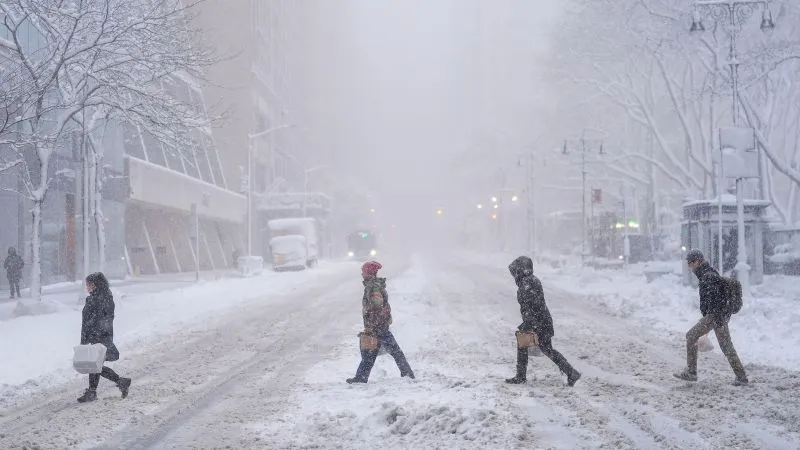
A rapidly intensifying nor’easter has impacted New York City and much of the Northeast, delivering heavy snow, strong winds, and dangerous blizzard conditions from Sunday into Monday. As of 1 p.m. ET, Central Park recorded 19.7 inches of snow, marking it as the ninth-snowiest snowstorm since 1869. Reports indicate that parts of eastern Staten Island received over 24 inches, while areas in Richmond and Suffolk counties reported more than two feet of snow.
Why It Matters
The storm has led to the cancellation of classes for New York City’s public schools on Monday, affecting approximately 1.1 million students across more than 1800 schools. Mayor Zohran Mamdani announced that classes would resume in person on Tuesday, emphasizing the importance of safety and accessibility for students and staff. The acting deputy chancellor for operations, Kevin Moran, assured that mass transit and school buses would be operational, allowing students to return to school.
What’s Next
Looking ahead, the National Weather Service predicts additional snow showers on Tuesday evening, with minor accumulations expected. Snowfall may continue until Wednesday morning, transitioning to rain later in the day. By Thursday, more snow mixed with rain is anticipated, although total accumulations for the remainder of the week are expected to be less than two inches. Temperatures are projected to rise into the 40s, potentially accelerating snowmelt.
You may also like